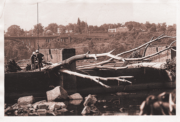
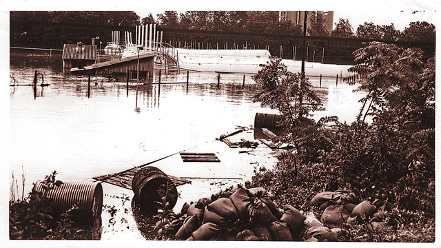
On June 19, 1972, a weak Category One hurricane hit the gulf coast of Florida. By the time it reached Virginia a few days later, Hurricane Agnes was just a tropical storm, although its fourteen inches of rain combined with another low-pressure front and resulted in record flooding throughout the Mid-Atlantic.
 At the city locks of Richmond, the James River crested at thirty-six-and-a-half feet, smashing the 1771 record of thirty feet. For some perspective, the James River’s flood stage – the level at which a body of water’s surface has risen to a level to cause sufficient inundation of areas that are not normally covered by water – is twelve feet.
Water infiltrated the city as far as 7th Street on the Southside, and went past Marshall Street on the downtown side. The 9th Street, Boulevard, and Huguenot bridges became inaccessible, while the 14th Street Bridge disappeared completely underwater. Interstate 95 on the Southside was under water as well. Gillies Creek in Richmond’s East End backed up and flooded Fulton, Shockoe businesses became submerged, and the inundated wastewater treatment plant left an estimated 100,000 people without potable water.
For days, gas and electrical services were inoperable. Devastating Richmond just three years after the historic flood from Hurricane Camille, it was Hurricane Agnes in 1972 hurricane that prompted the Army Corps of Engineers to begin planning the floodwall that borders the river today. That project was dedicated more than two decades later, on October 21, 1994, at a cost of $143 million. It will be the site of the 2020 RVA Street Art Festival, April 16 through 19.
Photos: Finnegan Photograph Collection, The Valentine; Gary Burns, Richmond Times-Dispatch Collection, The Valentine


